Find a property on the map
Find a parcel on the map, adjust layers and search within an area.
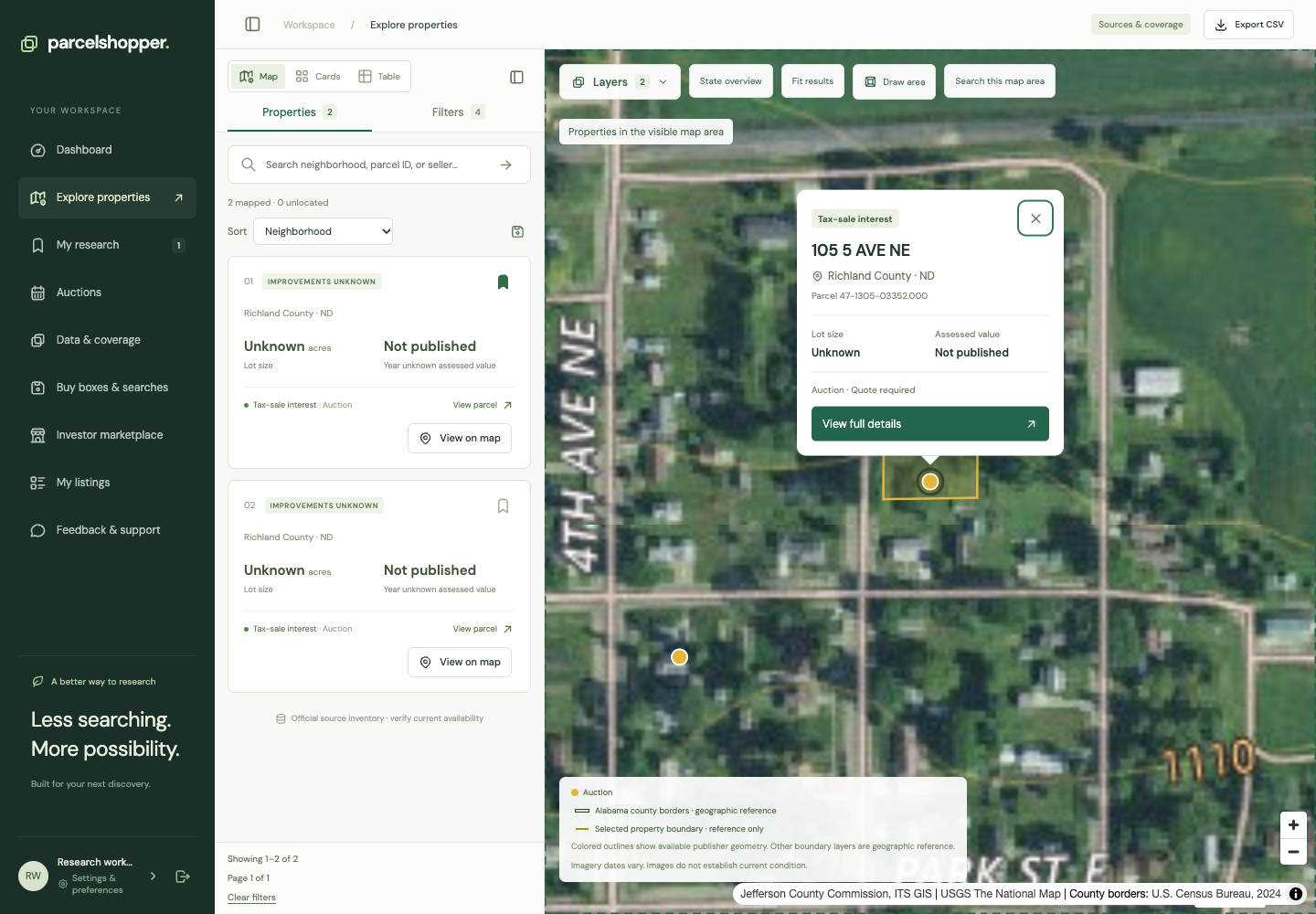
View on map focuses the workspace on a property's available location and opens a short summary.
Captured November 8, 2026. Imagery and boundary sources have their own dates.
Locate a property
- Find a candidate in Explore.
- Choose View on map on its card, table row or report.
- The map focuses on the location and opens a summary.
- Open the report from that summary for identifiers, sources and purchase routes.
If the record has no location, use its official parcel identifier to investigate. Do not substitute a nearby marker.
Adjust the view
State counts appear at a broad scale. Zoom in for individual properties and available boundaries. Fit results shows the extent of the current mapped results.
Use Layers to change the basemap and reference layers. Compare street and aerial views when examining roads and surrounding development. Legal access, use restrictions and current condition still need separate research.
Search an area
Choose Search this map area to use the visible bounds, or Draw area to define a search. Other filters still apply, including instrument and availability.
The app can remember your map view. If you return to a small area, check the bounds before assuming the wider catalog is empty.
Read the boundary source
County borders and publisher parcel geometry are separate layers. A point or polygon is a research reference, not a legal survey or proof of access.
See property report help for source details and the due diligence checklist for further checks.


Discussion